December 31, 2025
Snow and Ice Management: Protecting Commercial Roofs and Building Exteriors from Winter Strain
Winter conditions like snow and ice create a very different operating environment for
At BlueTeam, we specialize in tracking weather patterns, mapping client properties, and sending proactive alerts, giving property owners a head start in preparing for weather emergencies. Our dedicated team is also onsite within hours after a storm, ready to provide expert guidance when it’s needed most.
Thanks to our expertise, we’re uniquely positioned to both understand and address the full impact of this year's hurricane season and help clients navigate the challenges ahead.
In 2023, experts warned that the 2024 hurricane season could be one of the most destructive in recent history, predicting 25 named storms, 13 hurricanes, and 7 major hurricanes. Early on, it seemed they were mistaken. With only a few tropical systems forming and no major threats in sight, it appeared that the season would pass without major incident.
But everything changed in early July when Hurricane Beryl shocked the world by becoming the earliest Category 5 hurricane to form in the Atlantic in nearly a century. From there, the storm season took a devastating turn.
What started as a quiet season quickly escalated, with a surge of powerful storms wreaking havoc across the U.S. coastline. The quiet calm of the first months was shattered by hurricanes like Beryl, Helene, and Milton, each leaving a trail of destruction in their wake.
Explore how the predictions for 2024 went off course, why the first half of the season was so unexpectedly calm, and the key lessons business owners and commercial contractors alike can take from this unusual and catastrophic hurricane season.

As the 2024 hurricane season approached, meteorologists were bracing for an exceptionally active year, with predictions pointing toward a stormier and more intense season than usual.
Early projections suggested that the Atlantic basin could experience anywhere from 20 to 25 named storms, significantly above the historical average of 14. Among these, experts anticipated that 8 to 12 would strengthen into full-fledged hurricanes, with 4 to 7 reaching major hurricane status, potentially causing severe damage along the coastlines.
The forecasted activity was considerably more alarming than what the U.S. often faces in a hurricane season, where the average is about 7 hurricanes and 3 major hurricanes.
Adding to the urgency, meteorologists also warned of a higher-than-normal likelihood of direct impacts on U.S. territory, with projections of 4 to 6 storms making landfall. The possibility of even more activity was on the table, as there was a 10-15% chance of seeing more than 30 named storms.
With the potential for such intense weather systems, communities, businesses, and local governments across the eastern U.S. were urged to bolster their emergency plans and disaster response strategies well in advance of the season's official start.
As the season began, it seemed as though the forecasts might have been overly cautious. Despite the high expectations, the first few months of the 2024 hurricane season brought a welcome sense of relief.
By mid-June, there had been minimal storm activity, with only a handful of tropical storms forming. Meteorologists were left puzzled as they monitored a quieter-than-anticipated start, far from the explosive season that had been forecast.
One of the key contributors to the calm start was the shifting position of the Intertropical Convergence Zone (ITCZ). This atmospheric zone, where the trade winds from both hemispheres meet, typically plays a significant role in the formation of tropical storms.
In 2024, the ITCZ was farther north than usual, causing tropical waves to form over cooler waters. Without the necessary warm waters to fuel their growth, these tropical waves failed to develop into full-fledged storms, leading to a relatively quiet start to the season.
In addition to the shifting ITCZ, tropical waves were encountering dry air from the Sahara Desert. The dry air acted as a suppressant, weakening potential storms before they had the chance to strengthen.
The presence of Saharan dust was also more prevalent than anticipated, limiting the development of tropical systems and further contributing to the quiet start to the season.
Despite record-high sea surface temperatures, which would normally provide the necessary energy to fuel storm formation, the atmosphere lacked the vertical motion, or “lift,” required to sustain storms. Lift refers to the upward motion of warm air that creates the conditions for storm development.
Without this critical component, the warm waters alone were not enough to trigger the intensity seen in past seasons. Atmospheric stagnation was another reason for the slower-than-expected storm development in the early part of 2024.
In 2024, temperatures in the upper levels of the atmosphere were warmer than usual, acting as a cap that prevented rising air from fully developing into storm systems. Without this rising air, the development of hurricanes was stifled, adding to the lull in activity seen during the first months of the season.
A stable tropical atmosphere further hindered storm formation. The unusual stability in the atmosphere created conditions that were not conducive to the development of tropical storms or hurricanes.
While warm sea surface temperatures are a common catalyst for storm formation, the stability in the air prevented the necessary convection, or the upward movement of warm, moist air, that fuels the growth of tropical systems.

While the first half of the season was calm, the second half brought a stark contrast in storm activity. As predicted, the intensity of storms picked up significantly in the latter part of the season, with major hurricanes like Beryl, Helene, and Milton making landfall.
By October 2024, there had been 15 tropical cyclones, 10 hurricanes, and 4 major hurricanes, confirming that the season’s trajectory aligned with earlier forecasts for heightened activity in the latter months.
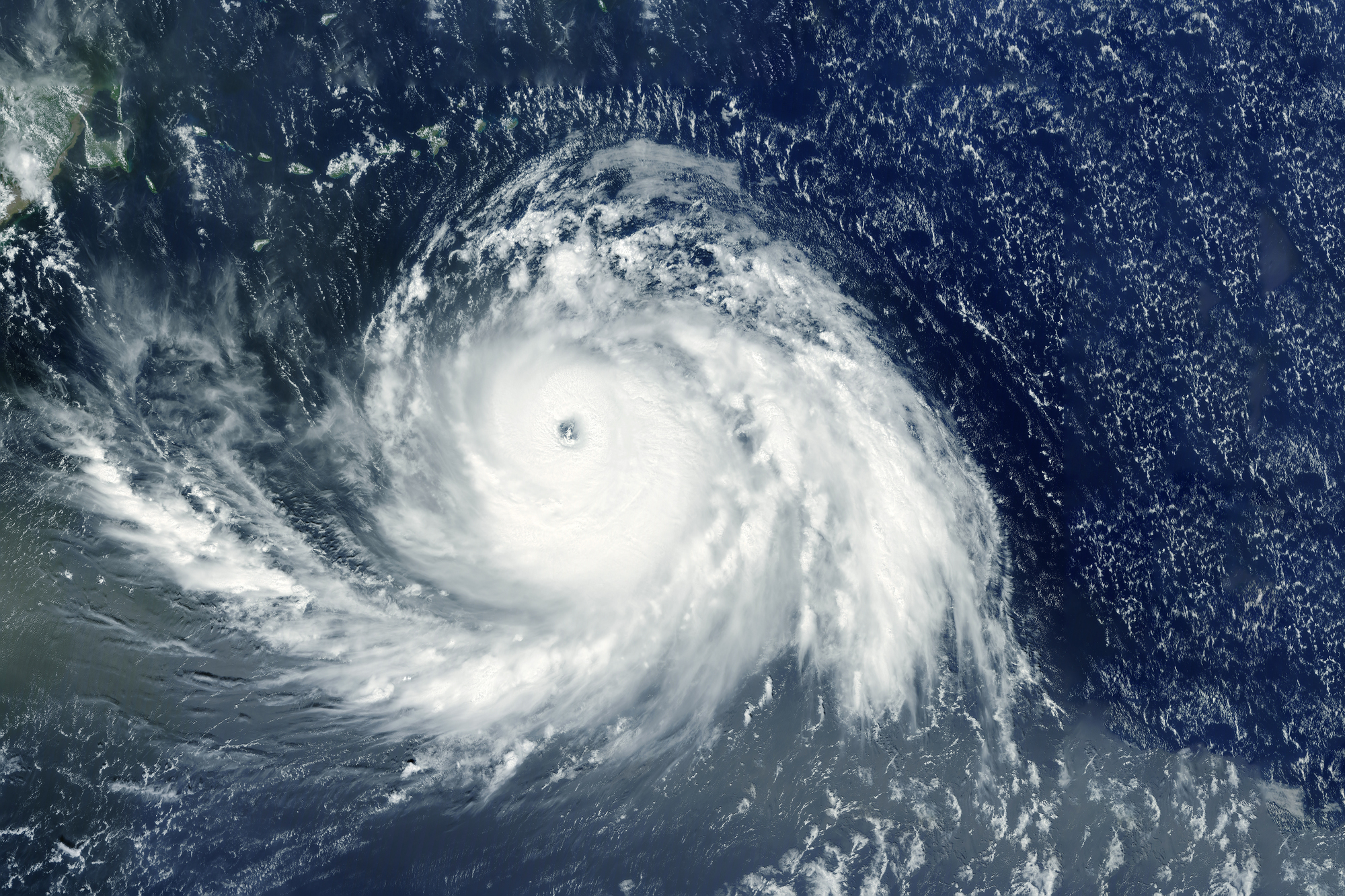
Hurricane Beryl made history in 2024 as the earliest Category 5 hurricane recorded in the Atlantic in nearly a century.
With wind speeds exceeding 160 mph, Beryl rapidly intensified as it moved westward across the tropical Atlantic, eventually making landfall on Carriacou Island in Grenada as a high-end Category 4.
It continued to strengthen into a Category 5 in the Eastern Caribbean but began weakening as it passed just south of Jamaica. After making landfall on the Yucatán Peninsula as a Category 2, Beryl weakened further as it traversed the Gulf of Mexico, eventually making landfall in Texas as a tropical storm.
Despite its weakening, Beryl caused significant damage across the Caribbean and the U.S. Gulf Coast. Its rapid intensification and unexpected path made it a stark reminder of the volatile nature of the 2024 hurricane season.
Hurricane Helene devastated communities across the Southeastern U.S. in September 2024, becoming one of the deadliest hurricanes of the year, with a death toll surpassing 100.
Helene’s path began as a Category 1 storm before rapidly strengthening to a Category 4 over the warm waters of the Gulf of Mexico. As it made landfall in Florida’s Big Bend, it unleashed catastrophic flooding, storm surges, and high winds, wreaking havoc across six states.
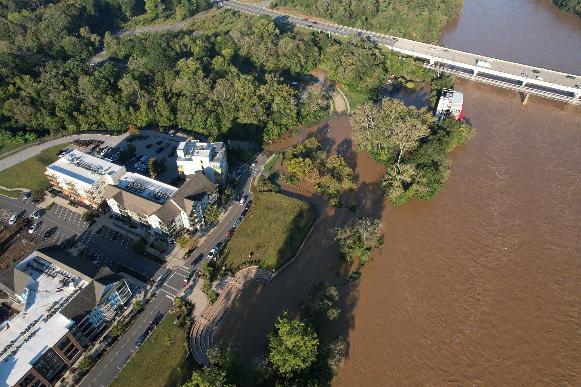
Helene's enormous rainbands and widespread winds, reaching over 70 mph as far as Miami, contributed to the record-breaking rainfall and flood crests in North Carolina and Tennessee. The storm's extended rainfall and massive storm surge caused significant devastation, leaving behind damage estimated between $225 to $250 billion.
Despite weakening over land, Helene's size and moisture content fueled its catastrophic impact far inland.
Hurricane Milton, which formed in early October, rapidly escalated into one of the most powerful storms of 2024.
With wind speeds reaching 175 mph within 24 hours, Milton became one of the fastest intensifying storms on record. The storm began as a tropical storm in the Gulf of Mexico, but by October 7, Milton had reached Category 5 status.
Milton’s rapid intensification and high wind speeds made it a major threat to Florida, where millions of residents scrambled to evacuate.
The storm’s rapid development underscored the growing concern that warmer ocean waters, driven by climate change, are fueling stronger, faster hurricanes that have the potential to cause widespread damage across the region.
The intensification of storms this year can largely be attributed to the ongoing effects of global warming. As ocean temperatures rise, they provide more energy for storm systems, leading to stronger hurricanes.
Warmer waters contribute to the increased evaporation of moisture into the atmosphere, which serves as fuel for the development of these storms. The shift in temperature patterns creates the conditions that foster more powerful hurricanes.
As predicted by scientists, global warming is leading to fewer storms overall, but the ones that do form are much more intense. This trend was clearly evident in 2024, with the latter part of the season witnessing a dramatic uptick in storm strength.
Not only did the storms form more rapidly, but they also escalated to higher categories in shorter timeframes, as was seen with hurricanes like Helene and Milton.
In addition to rising sea surface temperatures, changing atmospheric conditions also contributed to the spike in storm activity as the season progressed. Early in the season, the atmosphere remained relatively stable, which inhibited storm development.
However, as temperatures continued to rise, the atmosphere became increasingly unstable. The transition allowed for the vertical lift needed to drive storm formation, breaking down the atmospheric conditions that had been suppressing storm growth earlier on.
This change in the atmosphere meant that the conditions became more conducive for hurricane development, especially as moisture from the oceans began to meet warmer upper-level air.
As a result, by mid-season, storms that were already forming were able to intensify rapidly, contributing to the increased severity and frequency of major hurricanes.

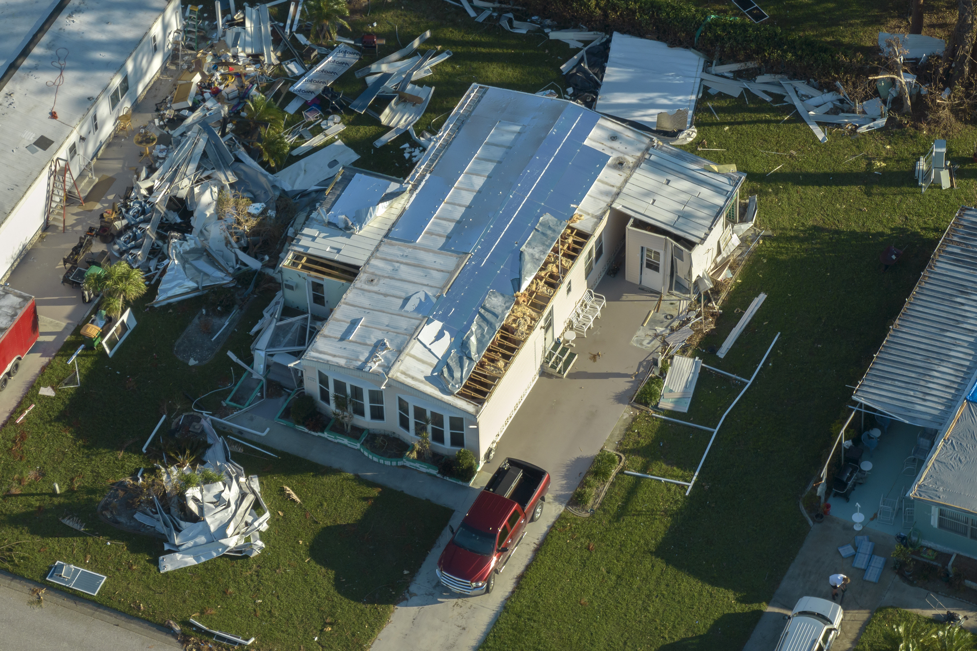
At BlueTeam, we understand the challenges that come with the aftermath of a major storm. Our restoration and emergency services are designed to help commercial property owners recover quickly and effectively.
Whether you’re dealing with water damage, structural repairs, or mold remediation, BlueTeam is here to assist you with the expertise and resources needed for a fast recovery.
When disaster strikes, having a reliable partner for restoration services can make all the difference. Contact BlueTeam today to learn how our team can help you restore and rebuild after a hurricane.